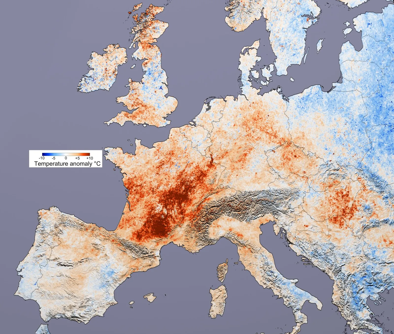
A "heat dome" is not a precise scientific term, but it describes a real and increasingly familiar phenomenon: a sprawling, stubborn area of high pressure that parks over a region for days or weeks and bakes everything beneath it. As Europe endures another bout of dangerous heat, the phrase is everywhere in forecasts. Here is the meteorology behind it.
A lid of high pressure
The core ingredient is a strong, persistent ridge of high pressure high in the atmosphere. According to the US National Oceanic and Atmospheric Administration (NOAA), a heat dome forms when such a ridge builds over an area and lingers, acting like a lid that traps hot air near the surface.
The key to why a heat dome is so much hotter than ordinary summer weather lies in what high pressure does to the air. Within a high, air gently sinks. As that air descends, the rising pressure squeezes it, and compression heats it — a process called adiabatic warming. That sinking motion both prevents surface heat from escaping upward and warms the air further by compression.
This subsiding air also suppresses cloud formation. With clear skies, sunshine pours onto the ground largely unimpeded, driving daytime temperatures higher. The result is a self-reinforcing cycle: clear skies heat the surface, the high pressure prevents that heat from venting, and the descending air adds warmth of its own.
Why the heat refuses to move
A single hot day is not a heat dome. What makes these events so punishing is their persistence, and that is governed by the jet stream — the river of fast-moving air that steers weather systems from west to east across the mid-latitudes.
Normally the jet stream pushes weather along briskly. But sometimes its path develops large, looping meanders that stall, a situation meteorologists call "atmospheric blocking." When the pattern locks into the shape of the Greek letter omega (Ω) — a ridge of high pressure flanked by low-pressure troughs on either side — it can hold a heat dome in place for a week or more. The normal eastward march of weather grinds to a halt, and the same hot air mass sits and intensifies day after day.
What climate science says
Here the evidence is strong on one point and less settled on another.
The broad warming trend is well established. The Intergovernmental Panel on Climate Change (IPCC) concluded in its 2021 assessment that it is "virtually certain" that hot extremes, including heatwaves, have become more frequent and more intense across most land regions since the 1950s, and that human-caused climate change is the main driver. Europe is among the regions that have very likely seen an increase in heat extremes. A hotter baseline means that when a heat dome forms, it builds on already-elevated temperatures, pushing records higher.
For specific events, scientists use rapid attribution studies. Analysing the extreme 2021 Pacific Northwest heat dome, World Weather Attribution found the event was roughly 2C hotter than it would have been in a pre-industrial climate and "virtually impossible without human-caused climate change." The researchers were candid about uncertainty, noting the temperatures were so extreme they fell "far outside the range of historically observed temperatures."
What remains an area of active research is whether the blocking patterns themselves are becoming more common or persistent as the Arctic warms faster than the rest of the planet. Some studies suggest a wavier, more sluggish jet stream; others find the signal unclear. This is not yet settled science, and reputable forecasters caution against attributing any single block to climate change.
The bottom line: heat domes are a normal feature of summer weather, but they are now forming in a warmer world — and that makes the heat they trap more dangerous.